To View The Entire Photo Album Of This Event, Please Click On Either Photograph Above
Chase Target:
Walnut, Kansas
Tornadoes:
Funnel Clouds:
Wall Clouds:
Hail:
Flooding:
00
00
01
00
00
Storm Intercept Summary
Please Check Back, As I'm Currently In The Process Of Updating This Site!!!
AS TIME PERMITS, I WILL ADD NEXRAD WEATHER RADAR IMAGES OF THIS STORM EVENT IN THIS AREA OF THE PAGE.
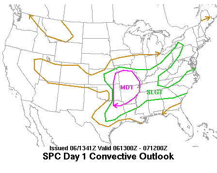
SPC Convective Outlook
At 7:41 AM CDT On May 06, 2003
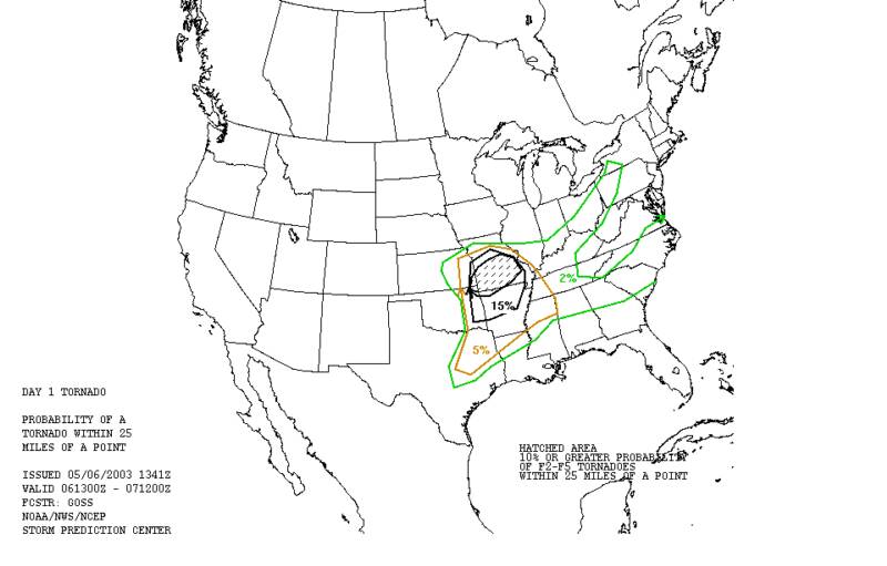
SPC Tornado Outlook
At 7:41 AM CDT On May 06, 2003
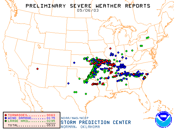
SPC Storm Reports For May 06, 2003
Photos Will Be Posted Very Soon!
None Found At This Time!
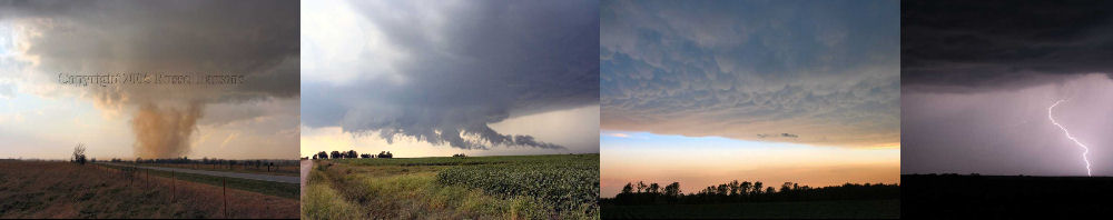
PHOTO GALLERY
NEXRAD WEATHER RADAR IMAGES
STORM PREDICTION CENTER CONVECTIVE OUTLOOK FOR THIS DAY
STORM REPORTS FOR THIS EVENT
NEWSPAPER ARTICLES AND OTHER STORM CHASER ACCOUNTS
Newspaper Articles For May 06, 2003
Other Storm Chaser Accounts For May 06, 2003
Huge Wall Cloud
May 06, 2003
National Weather Service Damage Assessment For May 06, 2003