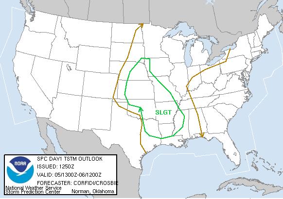
SPC Convective Outlook
At 7:50 AM CDT On April 05, 2005
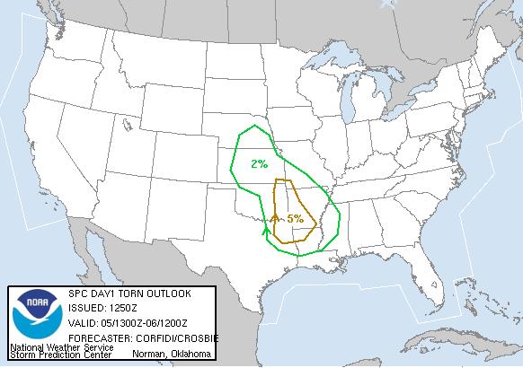
SPC Tornado Outlook
At 7:50 AM CDT On April 05, 2005
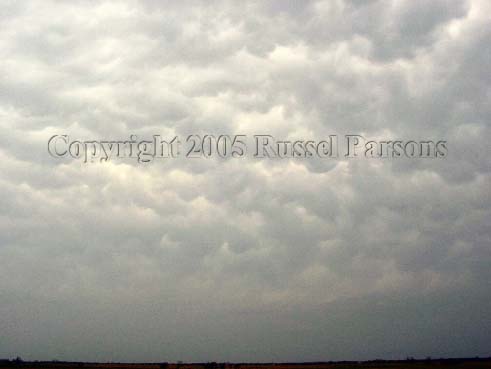
"Mammatus Clouds"
Looking West From Highway 28 In Southeast Nowata County, Oklahoma
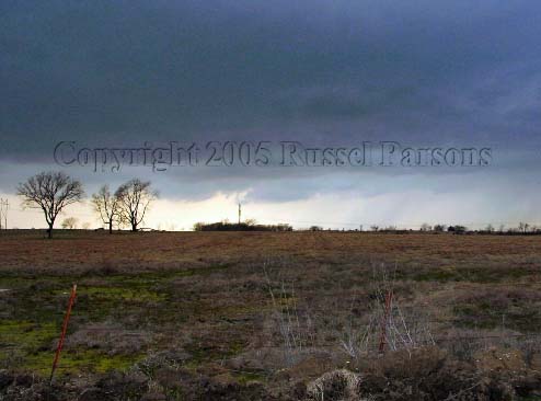
"Wall Cloud"
Approximately Three Miles Northeast Of Bartlesville, Oklahoma
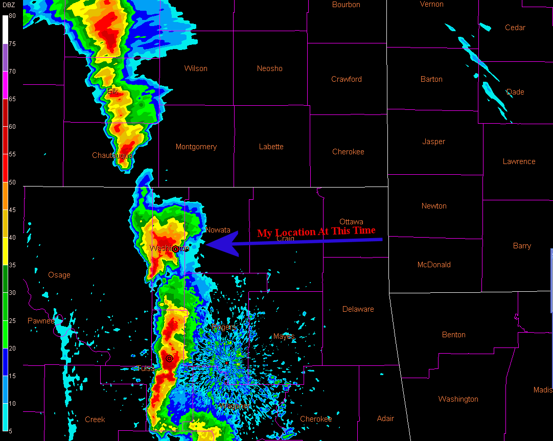
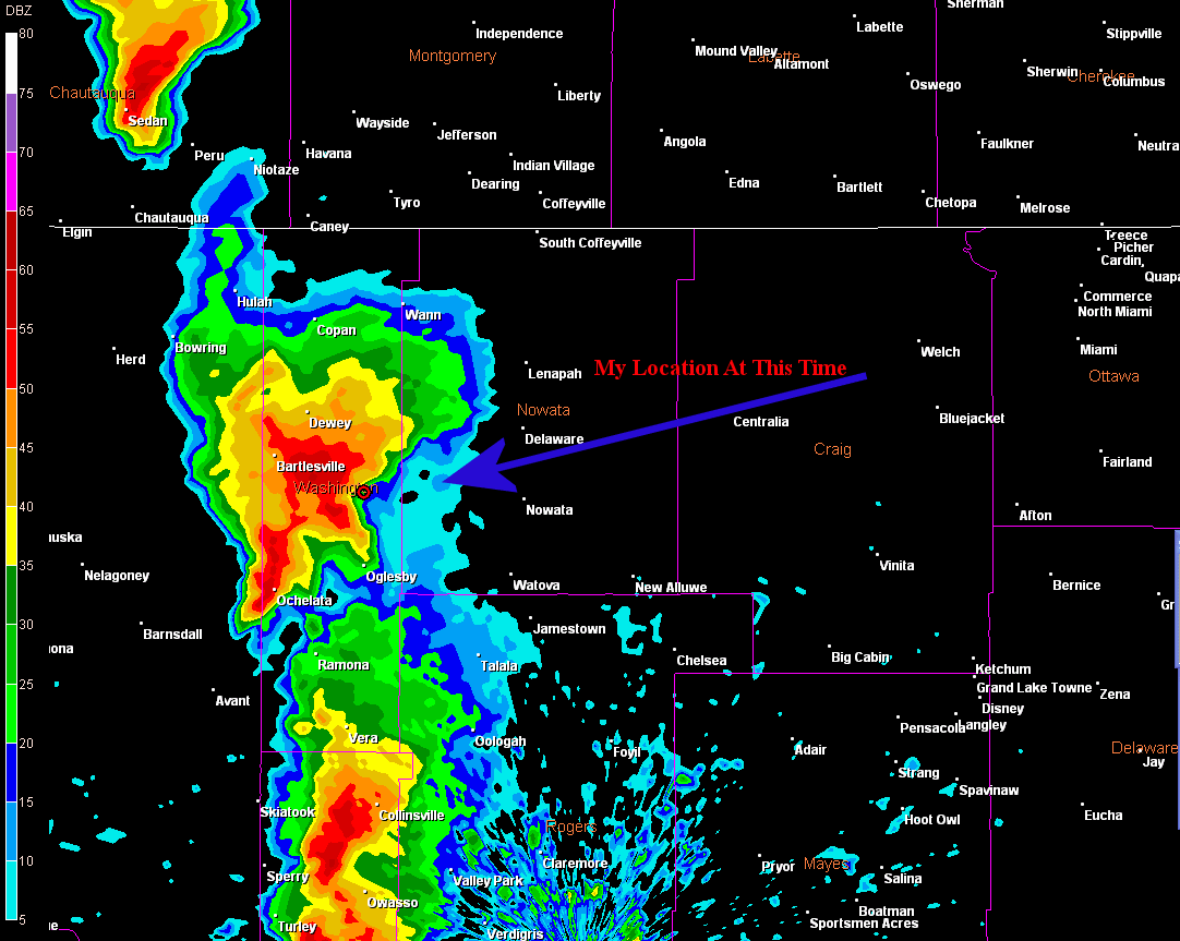
Tulsa Nexrad 4:41 PM CST
Tulsa Nexrad 4:41 PM CST (Zoomed)
To View The Entire Photo Album Of This Event, Please Click On Either Photograph Above
Storm Intercept Summary
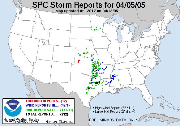
SPC Storm Reports For April 05, 2005
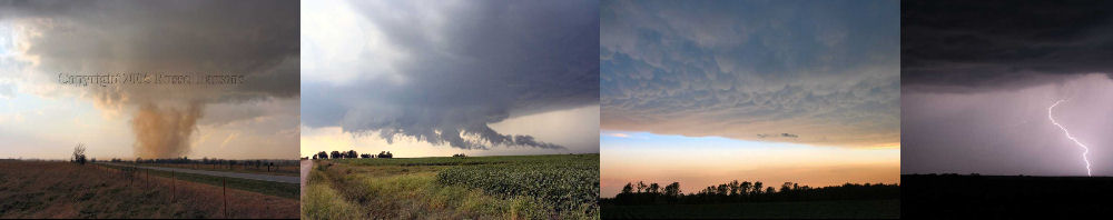
PHOTO GALLERY
NEXRAD WEATHER RADAR IMAGES
STORM PREDICTION CENTER CONVECTIVE OUTLOOK FOR THIS DAY
STORM REPORTS FOR THIS EVENT
NEWSPAPER ARTICLES AND OTHER STORM CHASER ACCOUNTS
Newspaper Articles For April 05, 2005
Other Storm Chaser Accounts For April 05, 2005
Bartlesville Supercell
April 05, 2005
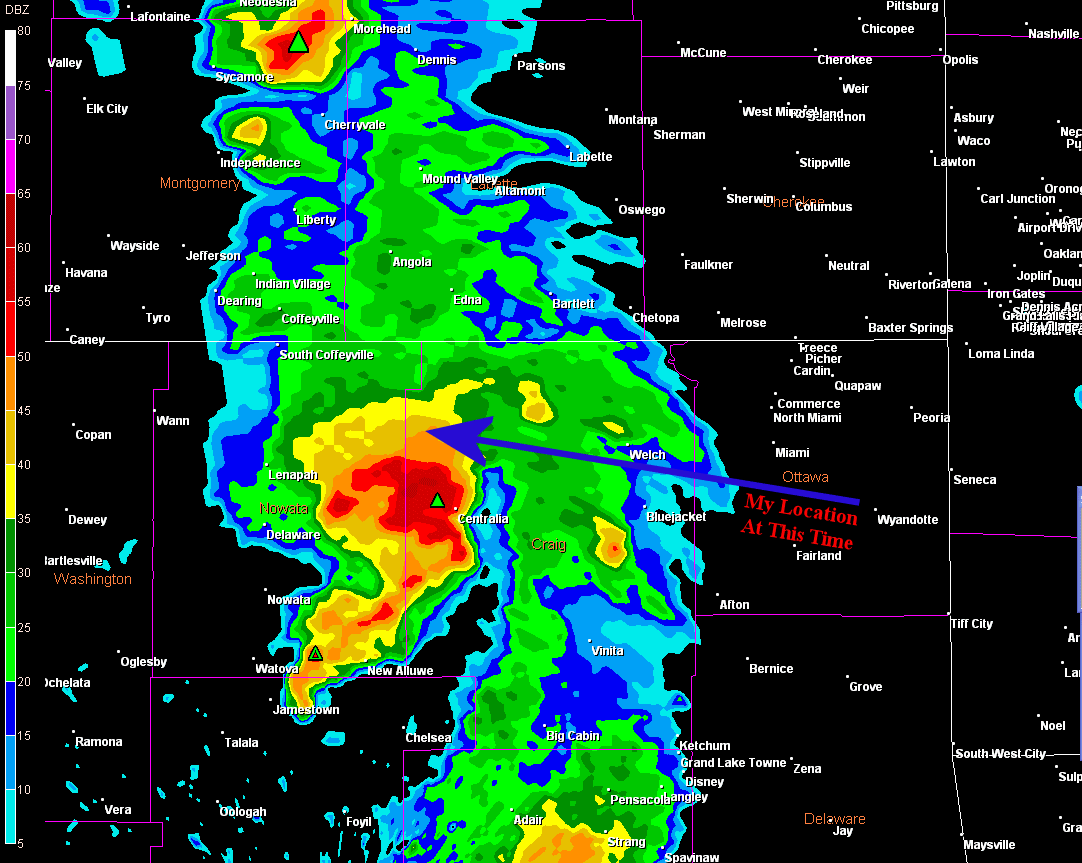
Tulsa Nexrad 6:07 PM CST (Zoomed)
Tornadoes:
Storm Chasing Blog
Chase Target:
Pryor, Oklahoma
00
00
Funnel Clouds:
Wall Clouds:
Hail:
Flooding:
No
02
No