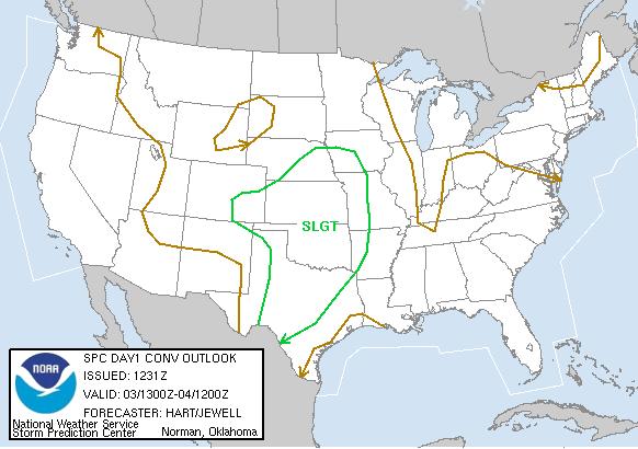
SPC Convective Outlook
At 7:31 AM CDT On June 03, 2005
SPC Tornado Outlook
At 7:31 AM CDT On June 03, 2005
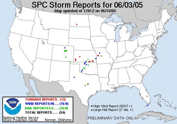
SPC Storm Reports For June 03, 2005
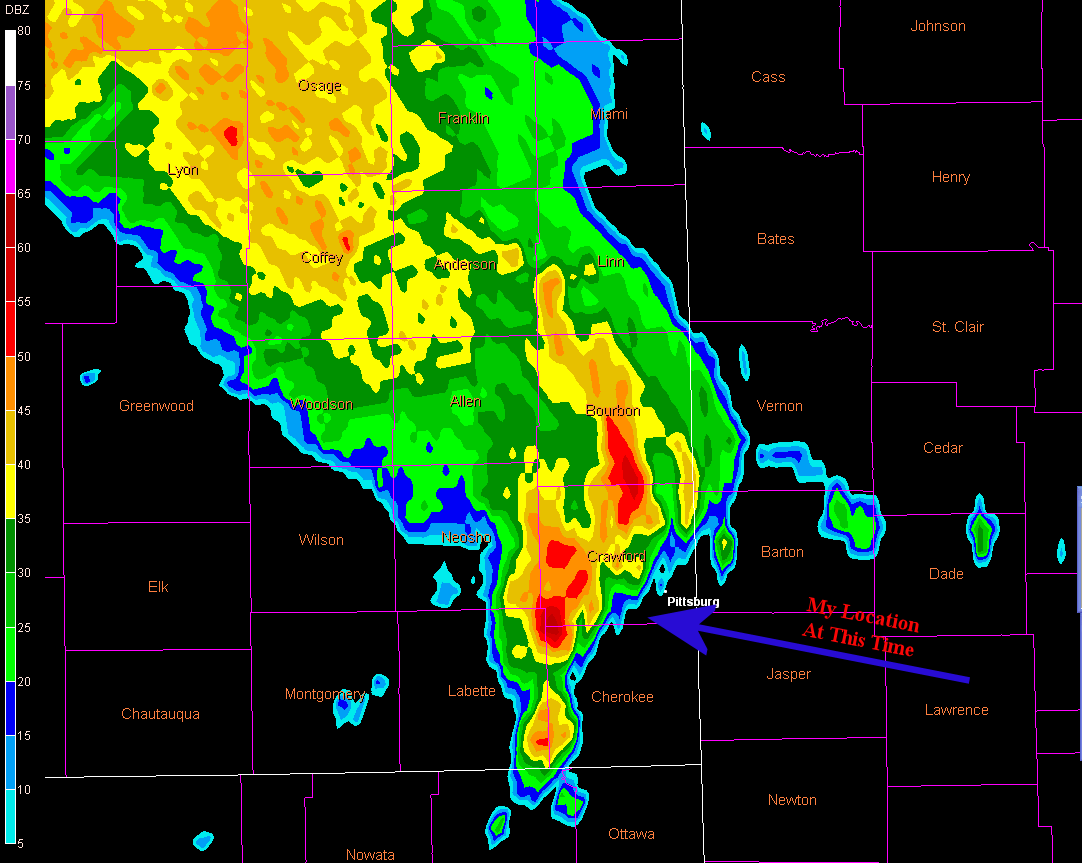
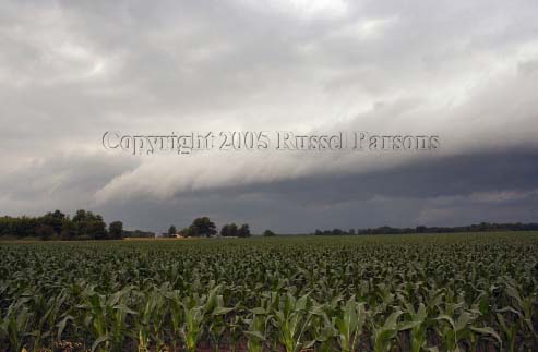
Gust Front Southwest Of Pittsburg, Kansas
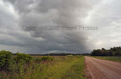
Same Gust Front As It Passes Overhead
No Newspaper Articles Or Other Storm Chase Accounts Have Been Located For This Event.

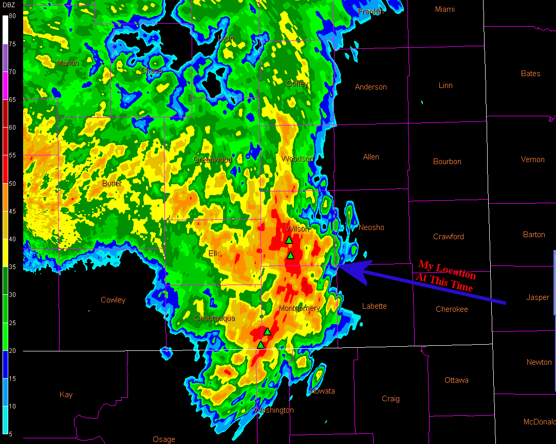
Wichita Nexrad 1:44 PM CST (Storms Near Chanute, Ks.)
To View The Entire Photo Album Of This Event, Please Click On Either Photograph Above
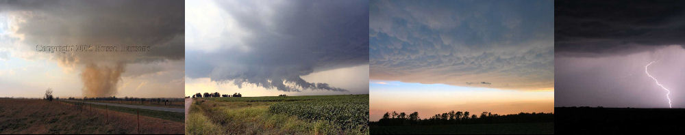
PHOTO GALLERY
NEXRAD WEATHER RADAR IMAGES
STORM PREDICTION CENTER CONVECTIVE OUTLOOK FOR THIS DAY
STORM REPORTS FOR THIS EVENT
NEWSPAPER ARTICLES AND OTHER STORM CHASER ACCOUNTS
Newspaper Articles For June 03, 2005
Other Storm Chaser Accounts For June 03, 2005
Severe Multi-Cellular Mess
June 03, 2005
Wichita Nexrad 3:26 PM CST (Gust Front Near Pittsburg, KS.)
NWS Damage Surveys & Other Reports
Storm Chasing Blog
Chase Target:
Chanute, Kansas
Tornadoes:
00
00
Funnel Clouds:
Wall Clouds:
00
No
No
Flooding:
Hail:
Storm Intercept Summary
Today proved to be a not so eventful chase. I drove from Pittsburg, Kansas to Chanute, Kansas without seeing anything more than a few small hail producing severe thunderstorms. These thunderstorms were located between Independence, Kansas and Chanute. These storms were in the form of a multi-ceIlular squall line. I did not care to do any core punching today, so I decided to drive back home.
On my way home, I caught up with a nice gust front, which was located just southwest of Pittsburg, Kansas. I did get to take a few photographs of the gust front as it rolled through the area. No damage was reported with this thunderstorm.