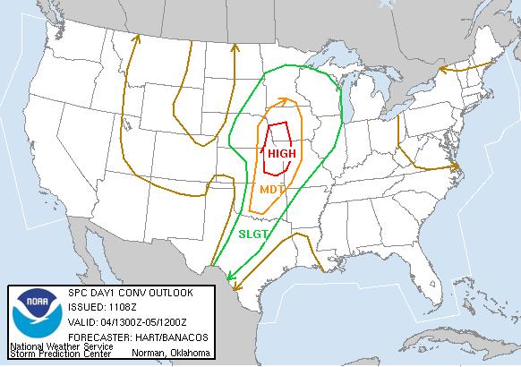
SPC Convective Outlook
At 6:08 AM CDT On June 04, 2005
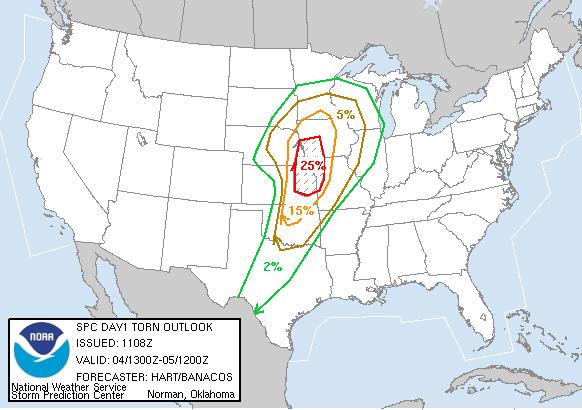
SPC Tornado Outlook
At 6:08 AM CDT On June 04, 2005
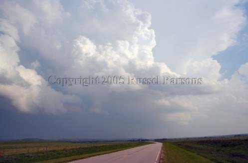
"Dying Severe Storm"
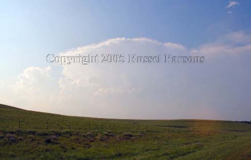
Looking South On Highway 177 South Of Cottonwood Falls, Kansas
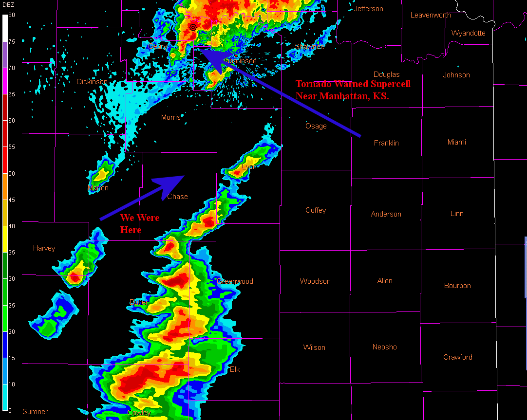
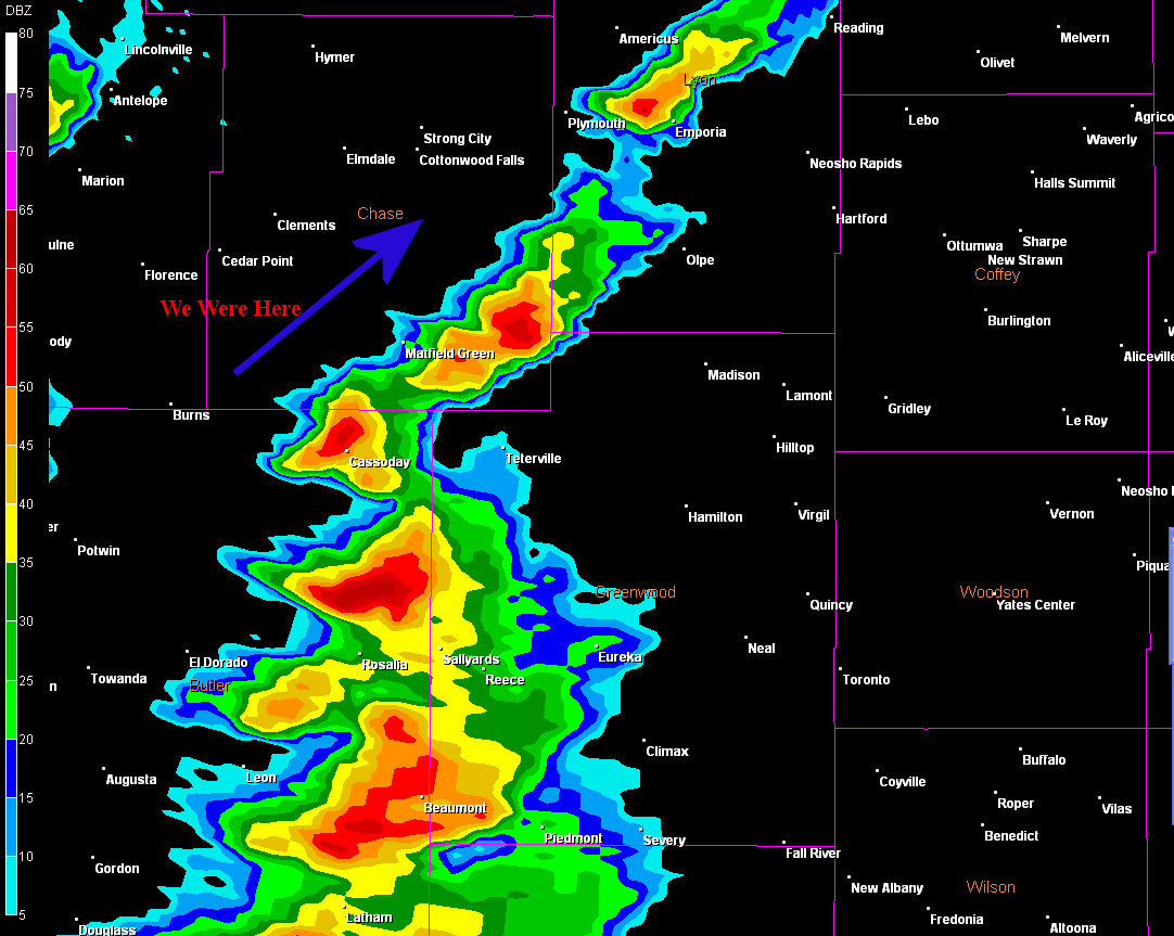
"Tornadic Supercell"
Looking North From Just South Of Cottonwood Falls, Kansas At Supercell Northeast Of Manhattan, Kansas
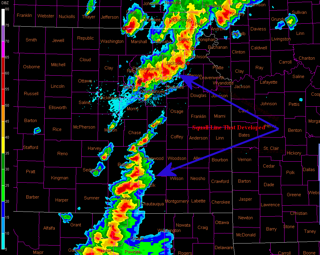
Topeka Nexrad 7:56 PM CST Showing How Storms Developed Into A Squall Line
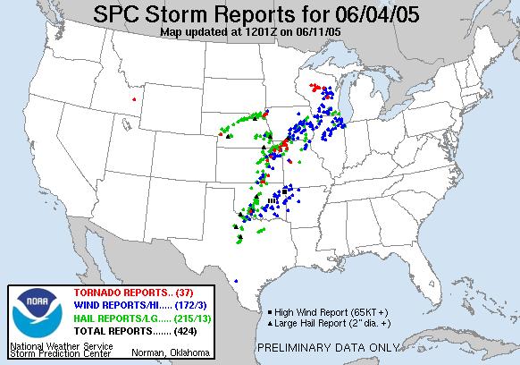
SPC Storm Reports For June 04, 2005
To View The Entire Photo Album Of This Event, Please Click On Either Photograph Above
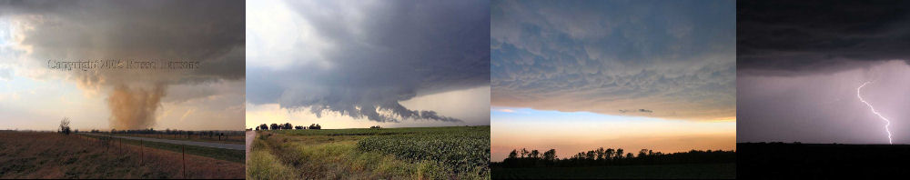
PHOTO GALLERY
NEXRAD WEATHER RADAR IMAGES
STORM PREDICTION CENTER CONVECTIVE OUTLOOK FOR THIS DAY
STORM REPORTS FOR THIS EVENT
NEWSPAPER ARTICLES AND OTHER STORM CHASER ACCOUNTS
Newspaper Articles For June 04, 2005
Other Storm Chaser Accounts For June 04, 2005
Storm Intercept Summary
Today started out as a potentially exciting storm chasing day. The Storm Prediction Center was predicting that east central Kansas would probably explode with severe thunderstorms this afternoon, and the possibility of tornadic storms today also looked very promising.
Since this chase day fell on a Saturday, I contacted my dad, to see if he wanted to go storm chasing with me today. Today was the first storm chase that my dad has taken part in, and let me just say that it will probably not be his last chase. We took off towards our chase target of Emporia, Kansas. We checked data both in Yates Center, Kansas and again at a truck stop east of Emporia.
By the time we got to the west side of Emporia, Kansas, severe thunderstorms started firing between Emporia and Wichita along the dryline. The only downfall was that the storms quickly exploded and formed a squall line. This was bad news. Since the severe storms quickly developed into a squall line, they had no chance to develop any tornadoes.
Even though we didn't get to see any tornadoes today, I still got to show dad some awesome storm structure. Also if you've never been to this part of Kansas, it would be well worth the trip for the great scenery. We also got into some penny sized hail east of El Dorado, Kansas as we were heading for home.
A High Risk Disappointment
June 04, 2005
NWS Damage Surveys & Other Reports
Chase Target:
Emporia, Kansas
Tornadoes:
00
00
Funnel Clouds:
Wall Clouds:
00
Yes
No
Flooding:
Hail: