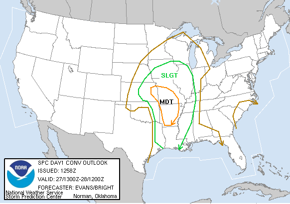
SPC Convective Outlook
At 6:58 AM CDT On
November 27, 2005
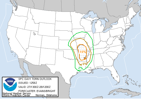
SPC Tornado Outlook
At 6:58 AM CDT On
November 27, 2005
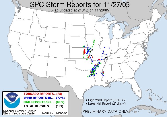
SPC Storm Reports For November 27, 2005
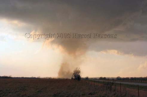
Looking West At Tornado As It Crosses K-146 Highway At Rooks Road
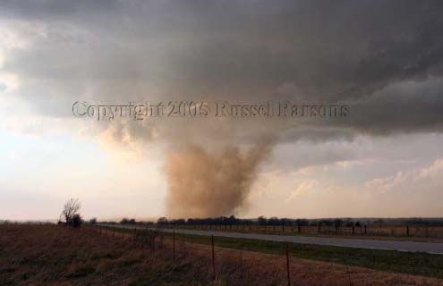
Looking West At Tornado After It Crossed K-146 Highway At Rooks Road.
Wichita National Weather Service Damage Assessment For November 27, 2005
You can read my post about this incident on the Stormtrack Forums
If anyone else has any links to this tornadic event please email your website link to me, and I will post it on my website. Thanks, Russel Parsons
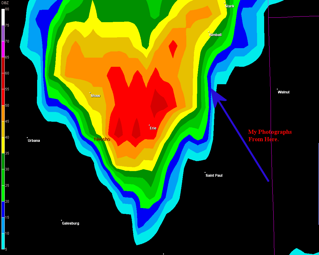
Wichita Nexrad 3:56 PM CST
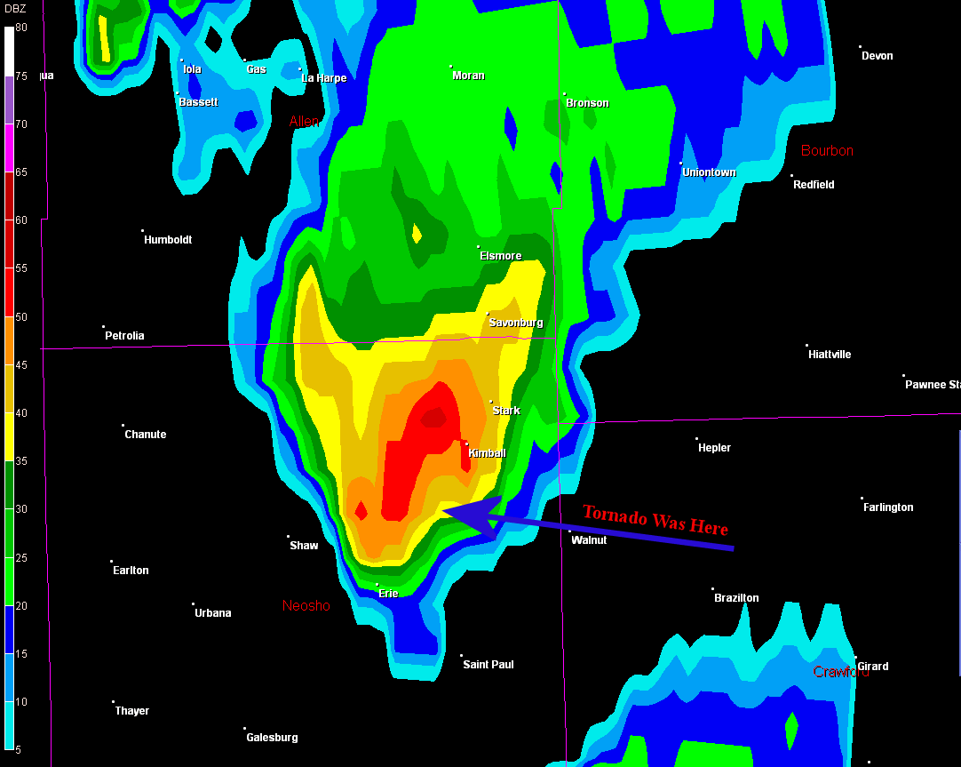
Wichita Nexrad 4:00 PM CST
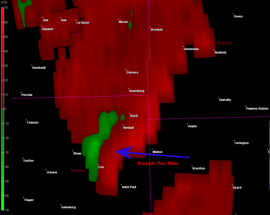
Wichita Nexrad 4:00 PM CST
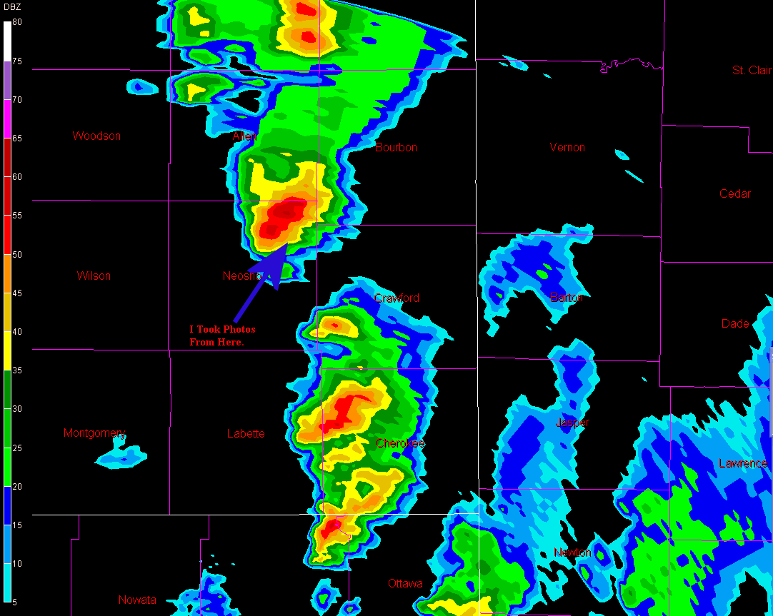
Tulsa Nexrad 4:03 PM CST
To View The Entire Photo Album Of This Event, Please Click On Either Photograph Above
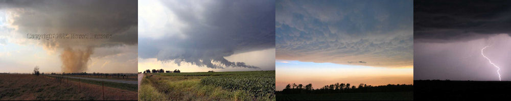
PHOTO GALLERY
NEXRAD WEATHER RADAR IMAGES
STORM PREDICTION CENTER CONVECTIVE OUTLOOK FOR THIS DAY
STORM REPORTS FOR THIS EVENT
NEWSPAPER ARTICLES AND OTHER STORM CHASER ACCOUNTS
Newspaper Articles For November 27, 2005
Other Storm Chaser Accounts For November 27, 2005
My First Daytime Tornado!!
November 27, 2005
Chase Target:
Walnut, Kansas
Tornadoes:
01
00
Funnel Clouds:
Wall Clouds:
01
No
No
Flooding:
Hail:
Storm Intercept Summary
I started the day at home keeping a close eye on my Nexrad weather radar computer and once again it payed off. A storm in Montgomery County, Kansas had been tornado warned, and I loaded up my chase gear and headed out towards Walnut, Kansas.
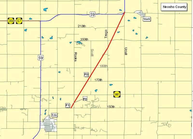
By the time I had arrived in Walnut, the tornado warned storm had weakened and the warning had been cancelled. The storms had been moving at a very fast clip of 50-60 MPH. I wasn't going to give up quite yet though. A severe thunderstorm warning had been issued for Northwest Labette County and Neosho County, Kansas for another storm to my southwest. This warning was quickly upgraded to a tornado warning for the same area.
I drove west on Kansas Highway 146 until I arrived on a very tall hill about 1/4 mile west of Udall Road In Neosho County. I could see the wall cloud associated with the new tornado warned storm, and a tornado dropped down from the sky 2 miles west of my location. The tornado was in my view for about five minutes, as it raced on north towards Stark, Kansas. This was a momentous day in my storm chasing career, as I witnessed my first daytime tornado.