Other Storm Chaser Accounts For June 03, 2008
Chase Target:
Northern Missouri
SPC Convective Outlook
At 7:59 AM CDT On
June 03, 2008
SPC Tornado Outlook
At 7:59 AM CDT On
June 03, 2008
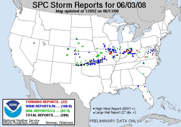
SPC Storm Reports For June 03, 2008
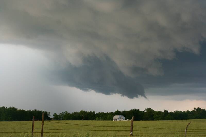
Rotating Wall Cloud 2 Miles South Of Polo, Missouri
Large Rotating Wall Cloud Located 2 1/2 Miles East Of Bogard, Missouri
No articles have been located about this event!!
Check Other Storm Chaser's Accounts For This Day At The Stormtrack Forums
These will be added when time permits...
To View The Entire Photo Album Of This Event, Please Click Here (Clicking The Slideshow Is The Best Option)
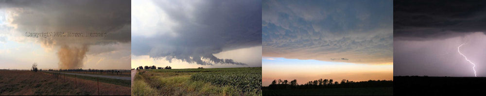
PHOTO GALLERY
NEXRAD WEATHER RADAR IMAGES
STORM PREDICTION CENTER CONVECTIVE OUTLOOK FOR THIS DAY
STORM REPORTS FOR THIS EVENT
NEWSPAPER ARTICLES AND OTHER STORM CHASER ACCOUNTS
Newspaper Articles For June 03, 2008
Storm Intercept Summary
I was desperate to get out and chase, so I took today off from work and decided to find some storms in northern Missouri. Things looked promising in this area with a decent chance for tornadoes.
I watched a nice storm develop in Soutwestern Caldwell County, Missouri, near Polo. This storm definately showed some signs of lower level rotation, and producing a pretty good looking wall cloud between the towns of Polo and Bogard.
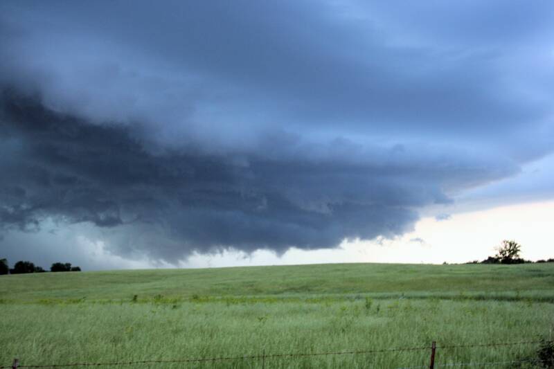
I followed this supercell thunderstorm into central Carroll County, Missouri, where I witnessed a small needle funnel cloud east of Bogard, Missouri on Highway 65. My view of this feature was obstructed by a hill, so I could not see if this funnel cloud was touching the ground. Therefore, I can only rule it as a funnel cloud and not a tornado.
This was a really nice chase, especially with storm speeds slow enough where I could keep up with this storm. I also haven't done much chasing in Northern Missouri, and the terrain and trees were not that bad in the area I chased in today.
Northwest Missouri Supercell
June 03, 2008
Tornadoes:
Funnel Clouds:
Wall Clouds:
Hail:
Flooding:
00
01
02
No
No